Demanding and exacting. Competent. MAP INDOOR partner network.
Your success is guaranteed.
Precision architectural models.
The pedestrian and cycle bridge project near the Holy Cross Church in Giesinger Berg, Munich.
The accuracy of an architectural model depends on the professionalism of the model data that underpins it. The MAP INDOOR partner network is your guarantee of success, because accuracy is our passion and long-standing expertise in data preparation our strength. We are highly professional in providing the data needed for architectural models of all kinds; and have been for two decades already.
MAP INDOOR has been working successfully hand in hand with AMOS Architekturmodellbau Süd for a long time to produce architectural models of the highest standard. The recipe for success: a high-precision, high-quality digital database combined with AMOS’s professional way of building explicit models.
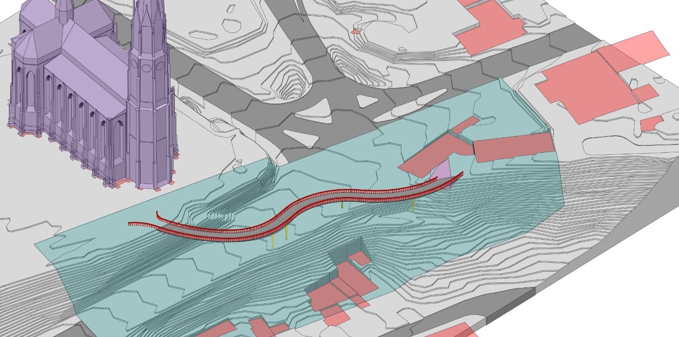
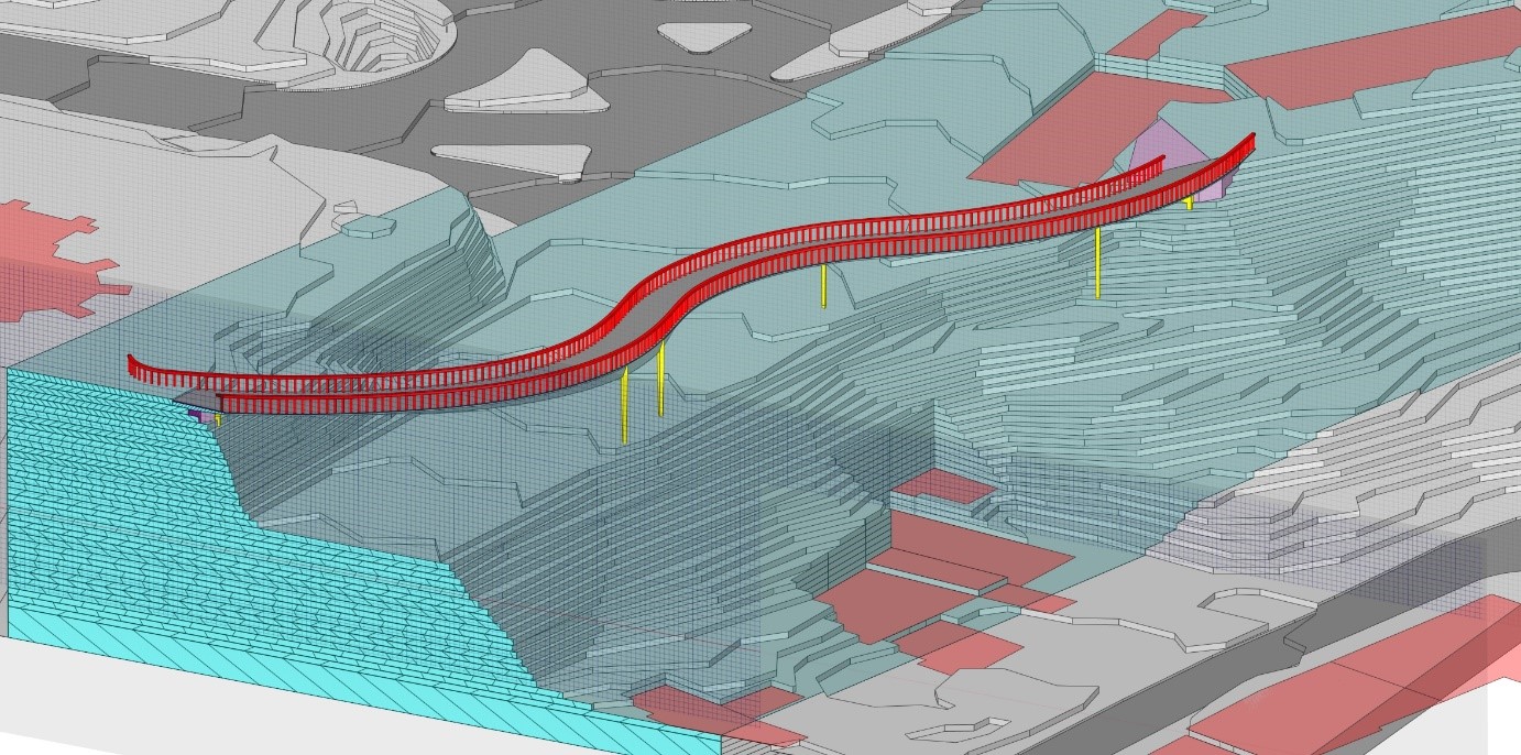
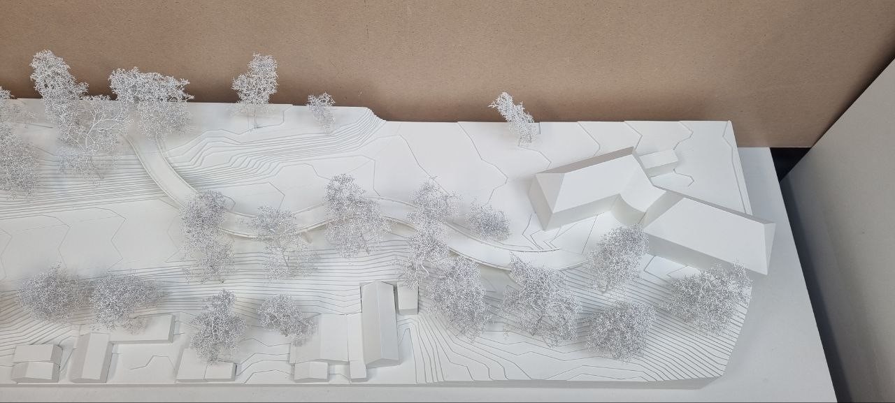
The competition model for the construction of a bridge for pedestrians and cyclists near the Holy Cross Church on the Giesinger Berg in Munich is highly topical. For this, the consortium karlundp Architekten and MayrILudescher Partner Beratende Ingenieure PartGmbB, with the engineering firm MayrILudescher for structural statics/planning, won the contract. The model was produced by Jürgen Schillinger and the AMOS Architekturmodellbau Süd team. The data captured and prepared by MAP INDOOR served as the basis.
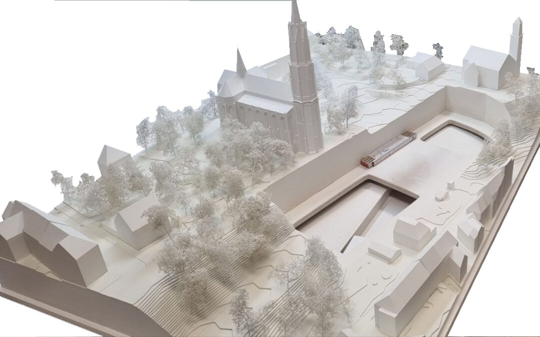
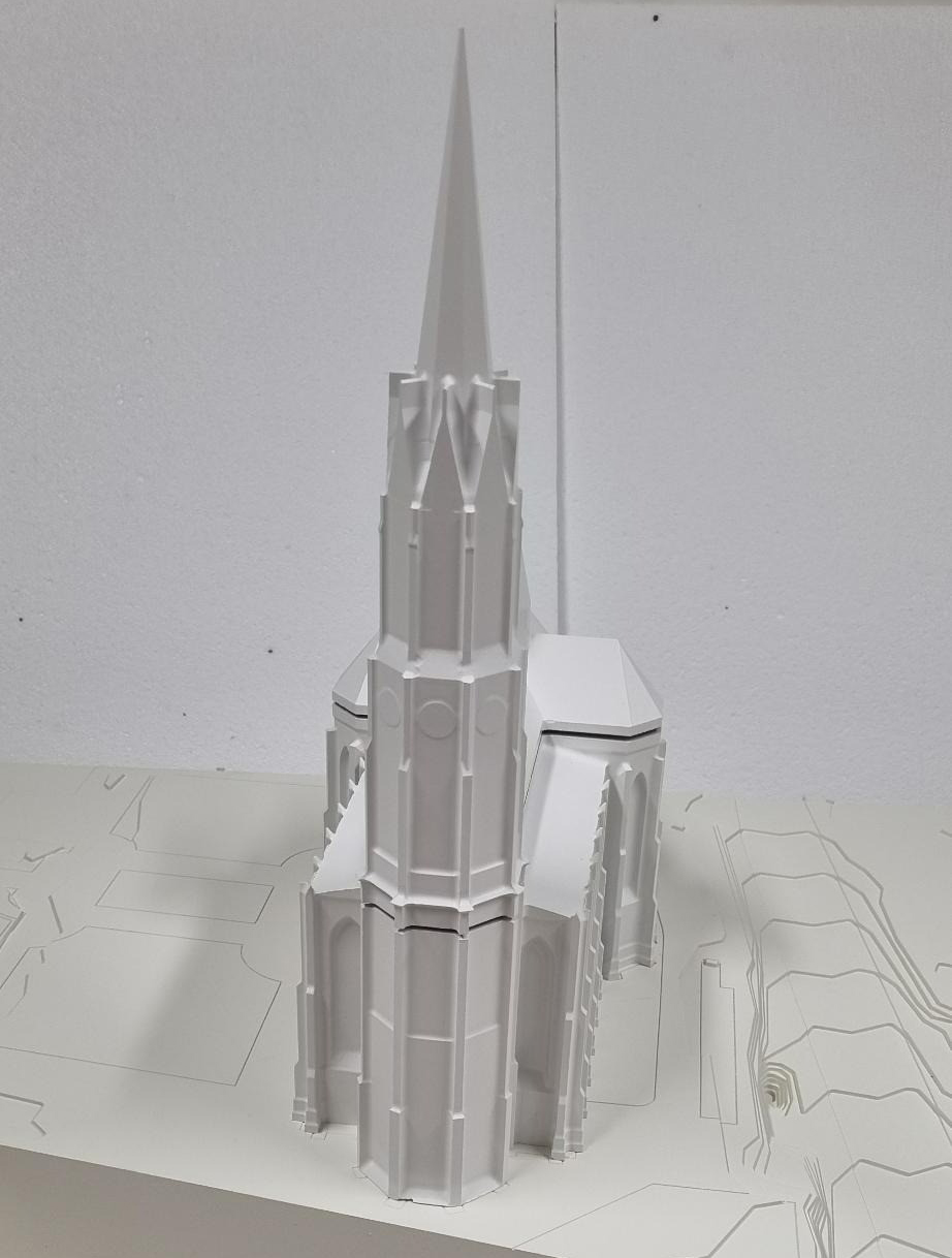
The Heilig Kreuz is the last fully preserved neo-Gothic church in the Bavarian capital. At 95 metres, it is also the second-highest church in Munich, and stands on the highest church square. In future, the planned new bridge over the Isar should link the two parts of Giesing, separated by the river, without obstacles for pedestrians and cyclists.
For the 3D model required as part of the architectural competition organised by the city of Munich, three data sets were relevant: terrestrial geographical data as well as basic digital data for the church and the bridge.
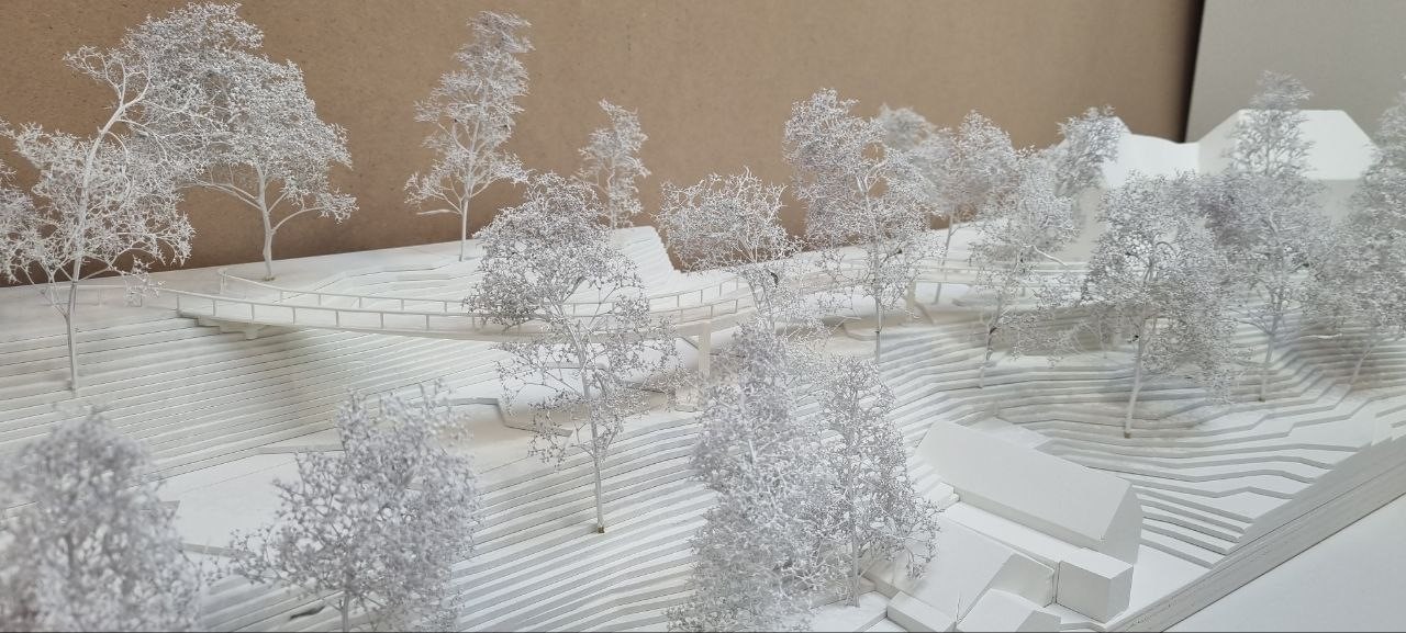
- The terrestrial geographic data captured was integrated into the terrain model, which consists of a 900mm long model plate and insert plate. The resulting data was used to create the level lines by NC milling. The model plate consists of 43 height layers and the insert plate of 38. The latter was used with 16 buildings on the southern slope.
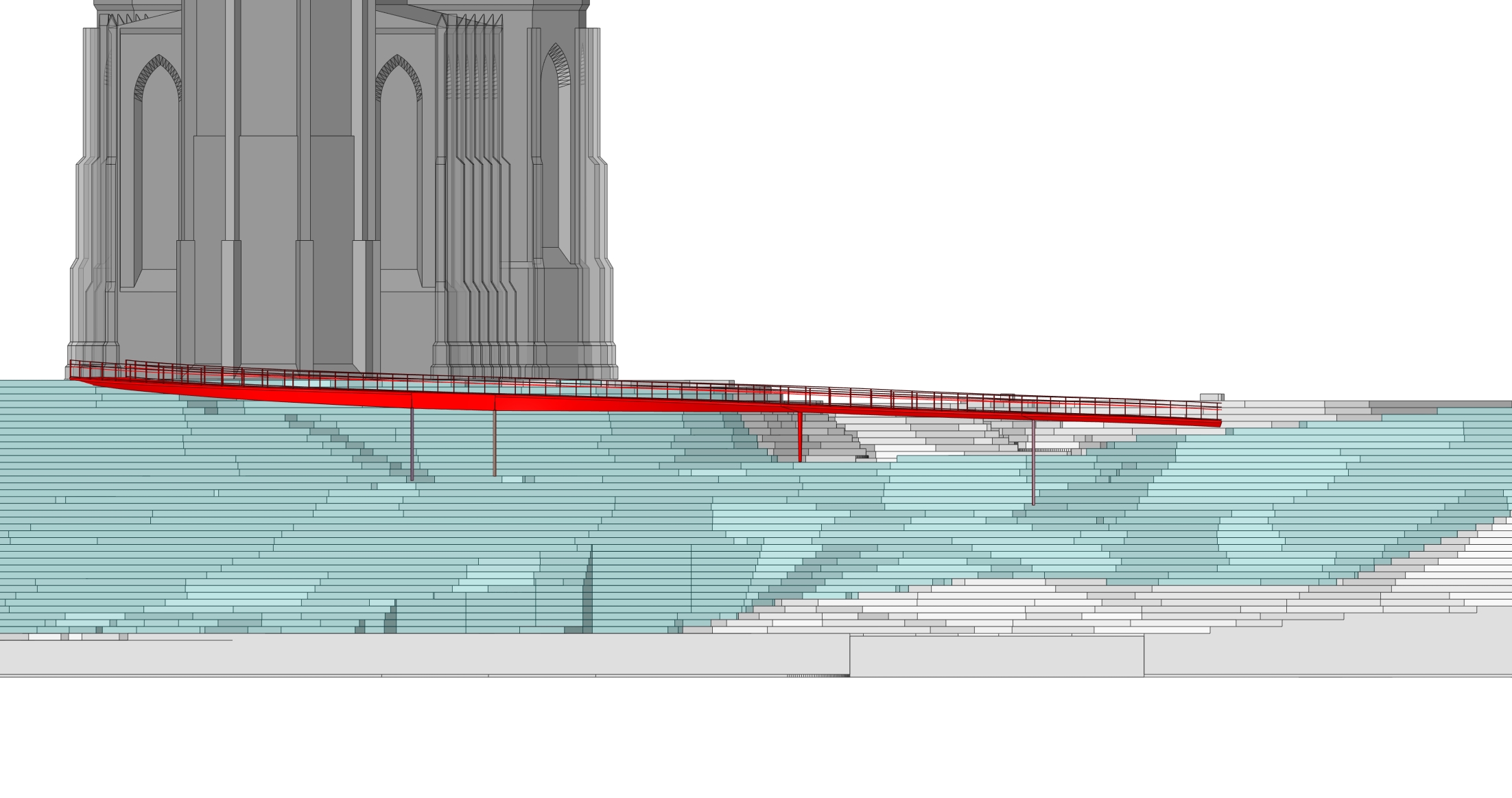
- The digital master data captured and prepared about the church was used for the accurate CNC milling. For this, the data had to be adapted, simplified and merged. In order to somewhat reduce the dominance of the filigree elements of the church facade in relation to the overall impression, the design of the facade was also taken into account and carefully integrated.
- Thedigital base data of the planned new bridge in turn generated an accurate model of it using 3D printing. The bridge model then fitted easily and accurately into the terrain model, demonstrating the accuracy of the data.
This work would not have been possible by hand. Without CAD, such a complex model cannot be created. Necessarily: accurate, user-friendly data preparation.
The winning model will soon be on display at Munich’s building department.
Come and see for yourself. And come and take a look at us too.
https://stadt.muenchen.de/rathaus/verwaltung/baureferat.html
1_Screenshot
2_Screenshot
3_Screenshot
5_Kirchemodell
6_Einsatzplatte Gesamt